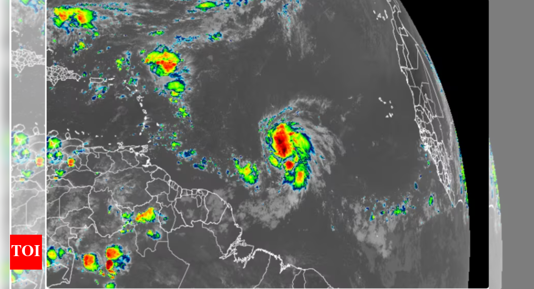
Tropical storm Jerry has formed over the central Atlantic ocean and is expected to strengthen into a category 1 hurricane by Wednesday, according to the US national hurricane center (NHC).As of 11:00am ET (local time) on Tuesday, Jerry had sustained winds of 45 mph and was located about 1,300 miles east-southeast of the northern Leeward Islands, moving westward. If the forecast holds, the storm will likely track near or just north of the Leeward Islands later this week, potentially bringing rain and wind to the region. “Tropical storm watches could be issued for parts of the islands by Tuesday night,” the NHC said in its latest update.
10th named storm of the season
Jerry is the 10th named storm of what has become a late-blooming Atlantic hurricane season. After a quiet mid-August, the basin has seen a surge in activity, with three hurricanes – Gabrielle, Humberto and Imelda – forming in just two weeks to close out September. Two of these – Gabrielle and Humberto – rapidly intensified, with Humberto reaching Category 5 status.Despite the recent uptick in hurricane activity, no hurricanes have made landfall in the US so far this season. If that holds through November, it would mark the first hurricane landfall-free Atlantic season in over a decade.
No threat to US mainland, but other areas under watch
Jerry is not expected to impact the US mainland, thanks to a cold front sweeping off the East Coast, which is likely to steer the storm out to sea. These cold fronts become more common in October and are known to deflect storms away from the coast. While the Atlantic may quiet down in the short term, late-season systems forming closer to land – especially in the Gulf of Mexico or western Caribbean – remain a concern for the US. According to hurricane expert Phil Klotzbach of Colorado State University, forecasters are monitoring conditions that could support storm development by mid-October, reported CNN.
Could late-season storms still form?
Historically, four named storms typically form in October and November, but the number and intensity can vary year-to-year. In 2023, only two storms formed during this period, while seven storms developed in the same months the year before.Meteorologists are closely watching for the possible formation of a Central American Gyre, a storm-generating weather pattern in the western Caribbean that is known for producing late-season tropical cyclones. While it’s too early to tell whether it will spawn a new system, forecasters will continue monitoring the region closely.
Storms late in the season can still be dangerous
Recent history shows that late-season storms can still be destructive. Hurricane Michael (2018) made landfall in Florida as a Category 5 hurricane on October 10 – the latest ever at that intensity. Similarly, hurricane Sandy in 2012 and hurricane Matthew in 2016 both brought significant impacts during October.The 2024 season’s recent activity began with hurricane Erin in August, followed by a quiet spell, before rapidly picking up in late September. With tropical storm Jerry now forming, attention is once again turning to the Atlantic and surrounding regions as the season enters its final stretch. Go to Source


